
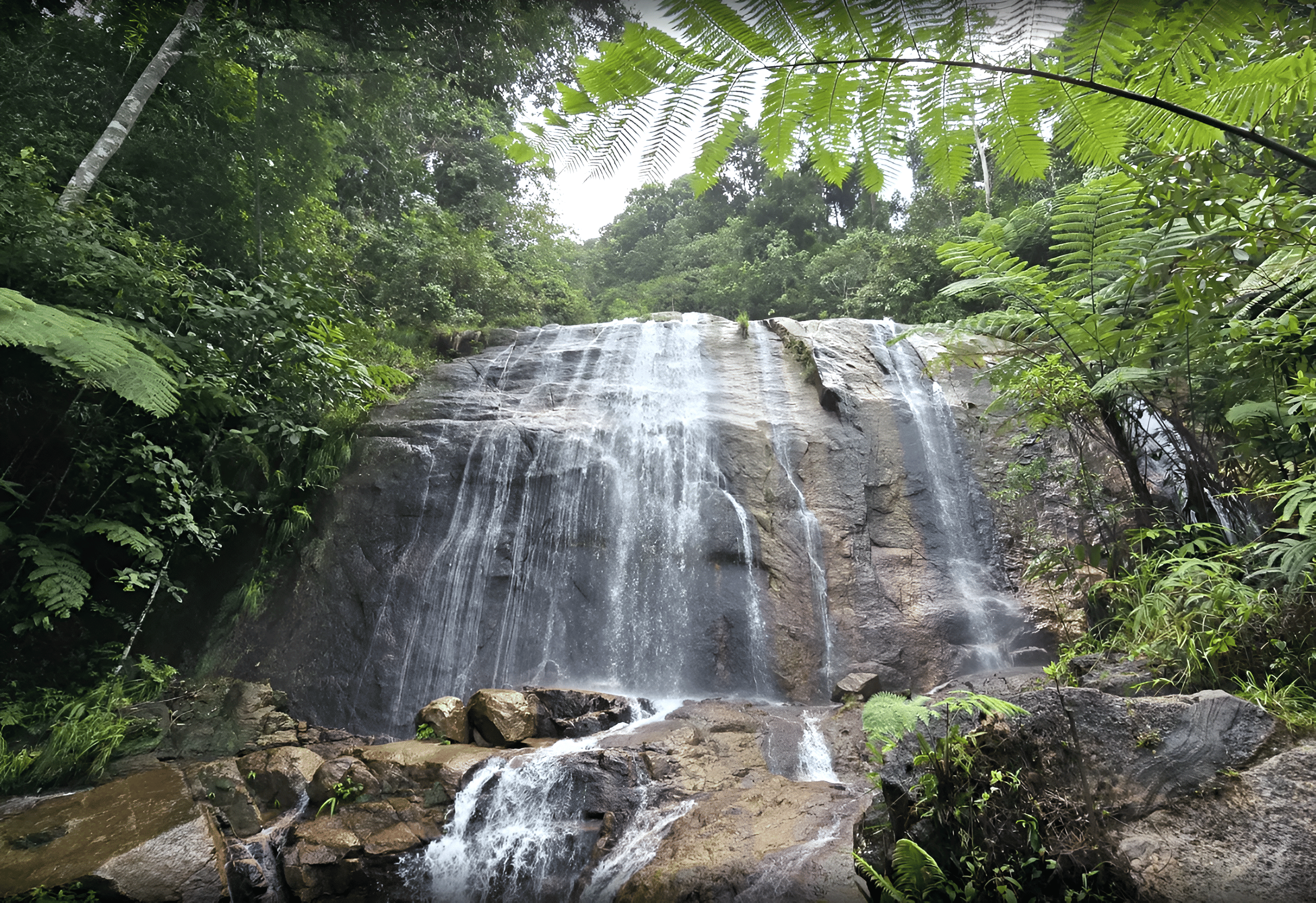
Lata Dinding Waterfall
Lata Dinding, Negeri Sembilan offers a moderately challenging forest hike through Kenaboi’s rainforest, leading to a scenic rock-faced waterfall—perfect for hikers seeking a quiet, refreshing escape deep in nature.
Background:
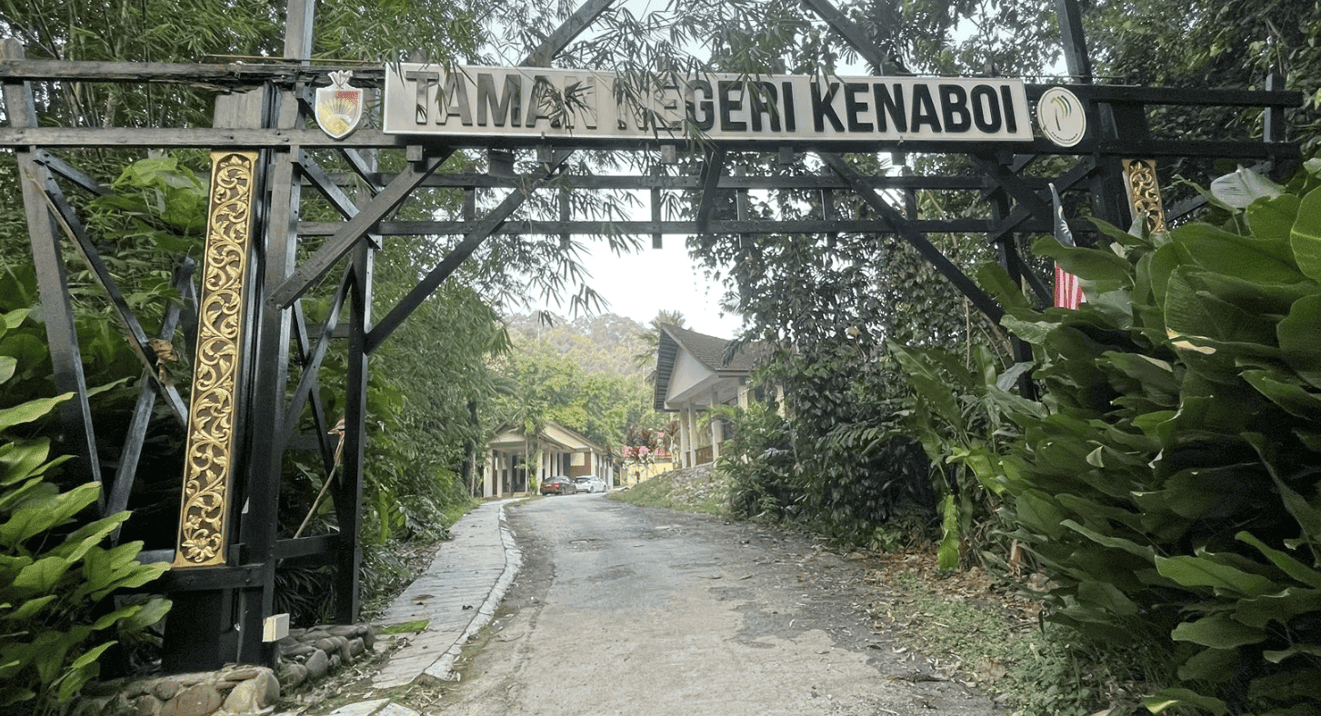
Lata Dinding, located within Taman Alam Liar Negeri Kenaboi, Jelebu, Negeri Sembilan, is a secluded and rewarding waterfall destination popular among hikers exploring the Kenaboi forest reserve. The area is often accessed via a scenic drive through the Hulu Langat route, passing Semenyih Dam before crossing into the southern reaches of the Titiwangsa Range, making the journey part of the overall adventure.
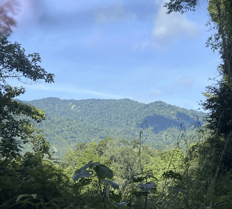
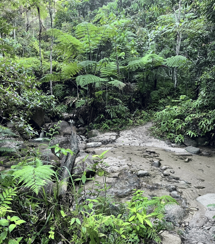
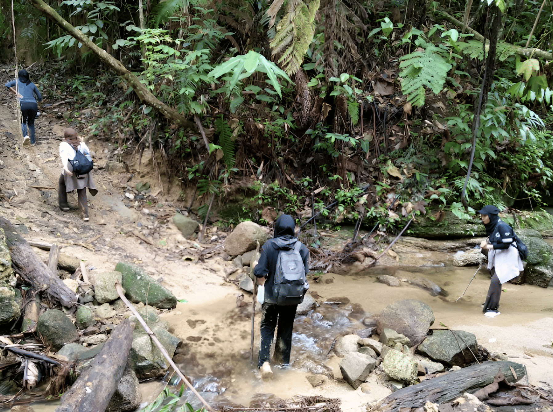
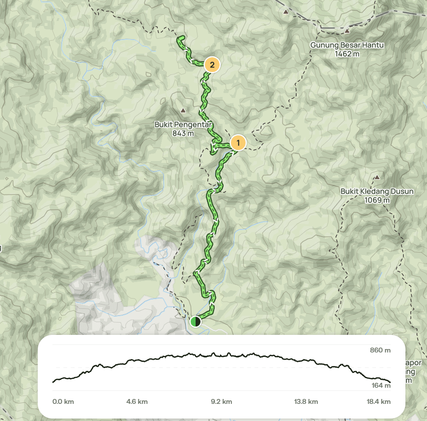
The hike to Lata Dinding follows forest trails and former logging paths, passing key checkpoints such as Y Junction, Kem Sungai Kering, and several river crossings along the way. The route involves steady ascents, uneven terrain, and sections that require patience and stamina, making it a moderately challenging hike suitable for hikers with reasonable fitness. While the trail is well-used by experienced hikers, navigation awareness remains important.
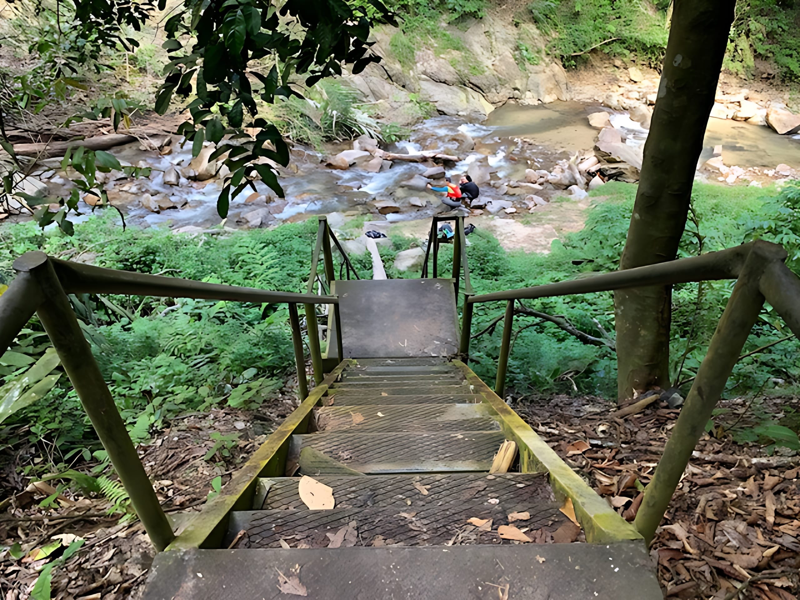
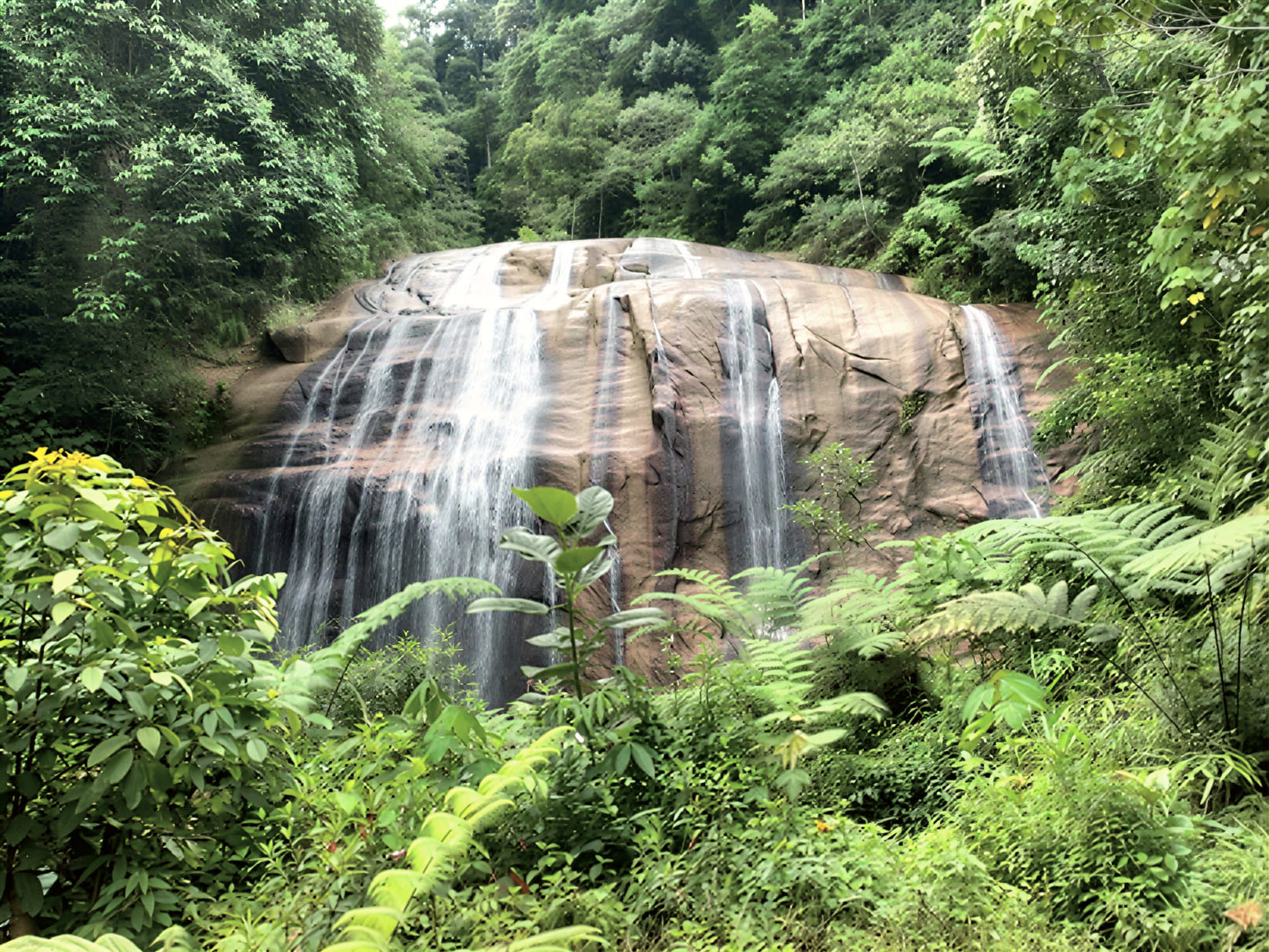
At the end of the journey, hikers are rewarded with the striking sight of Lata Dinding waterfall—a wide, rock-faced cascade flowing down natural stone “walls” into a clear river pool below. The waterfall offers a peaceful spot to rest, cool down, and enjoy the surrounding rainforest atmosphere before making the return hike. Often paired with nearby attractions such as Lata Kijang, Lata Dinding is a favorite destination for those seeking a quieter waterfall experience deep within Negeri Sembilan’s wilderness.
Photo credits:
© Meowtainpeople — meowtainpeople.com/lata-kijang-lata-dinding-jeram-berungut/
© Pokok Kelapa — pokokkelapa.wordpress.com/2020/08/11/lata -dinding-and-lata-kijang-hike/
Hike information:
📍 Location: Jelebu, Negeri Sembilan
📜 Permit: Mandatory
🧑✈️ Licensed MGP Guide: Optional for Malaysian Citizen / Mandatory for Foreigner
📏 Distance: ~ 20 km (Return)
📈 Elevation Gain: ~ 900 m / ~ 2,952 ft
⚠️ Difficulty Rating: 5/10 (Moderate)
📍 Peak Coordinates: 3°11'48.9"N 101°59'19.6"E 👉 [View on Google Maps]
👥 MGP Guide to Hiker Ratio:
- The standard MGP guide-to-hiker ratio is 1:7, but where guides are optional, the recommended ratio is 1:10.
- If your group has more than 7 or 10 participants, additional guides will be required to maintain the mandated safety ratio.
- This requirement ensures safety, compliance with forestry regulations, and a better hiking experience for all participants.
🔢 Ratio Examples (1:7):
- 1–7 hikers → 1 guide
- 8–14 hikers → 2 guides
- 15–21 hikers → 3 guides
- 22–28 hikers → 4 guides
🔢 Ratio Examples (1:10):
- 1–10 hikers → 1 guide
- 11–20 hikers → 2 guides
- 21–30 hikers → 3 guides
💬 Next Steps After Payment:
- 📧 Confirmation: You’ll receive a booking confirmation within 10 minutes. If you don’t receive a confirmation email, please contact our customer support team.
- 📱 WhatsApp Group: All registered participants will be added to a dedicated WhatsApp group for final updates, reminders, and important hike information.
- 🎫 Voucher Type: Please present your mobile voucher along with your identification or passport on the day of the hike.

