


Gunung Rajah via Kuala Kubu Bharu
A true test of endurance, this notorious long "dragon's back" trail demands everything you've got.
Background:
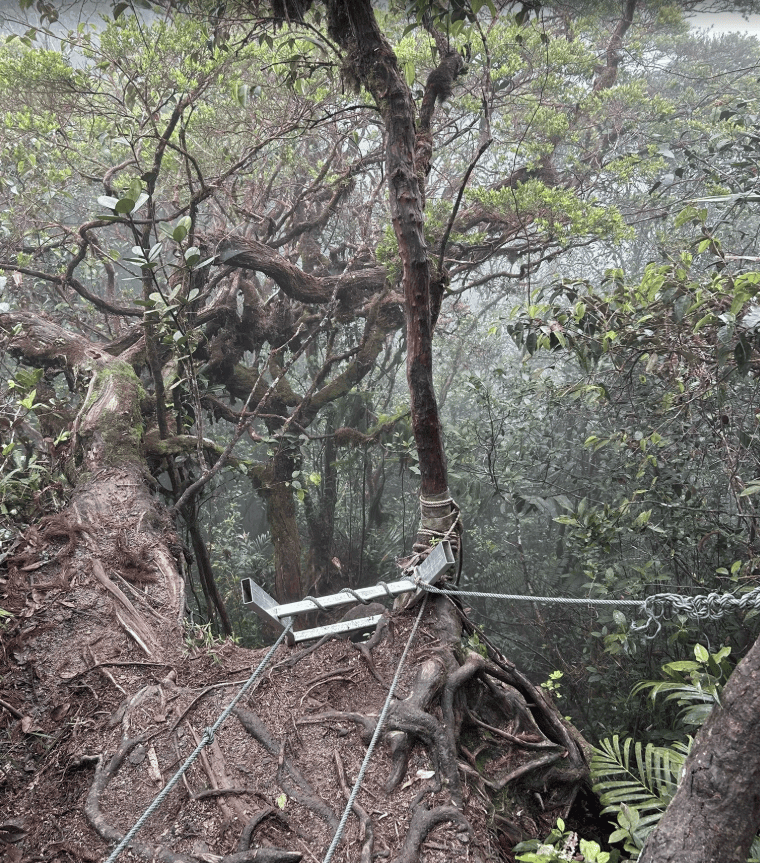
Gunung Rajah, located on the Selangor–Pahang border, is known for its tough and demanding hike. The Kuala Kubu Bharu (KKB) route is especially challenging, featuring long stretches of steep ascents and descents along a “dragon’s back” trail. Expect muddy, slippery terrain with thorny plants and fallen trees that require extra caution.
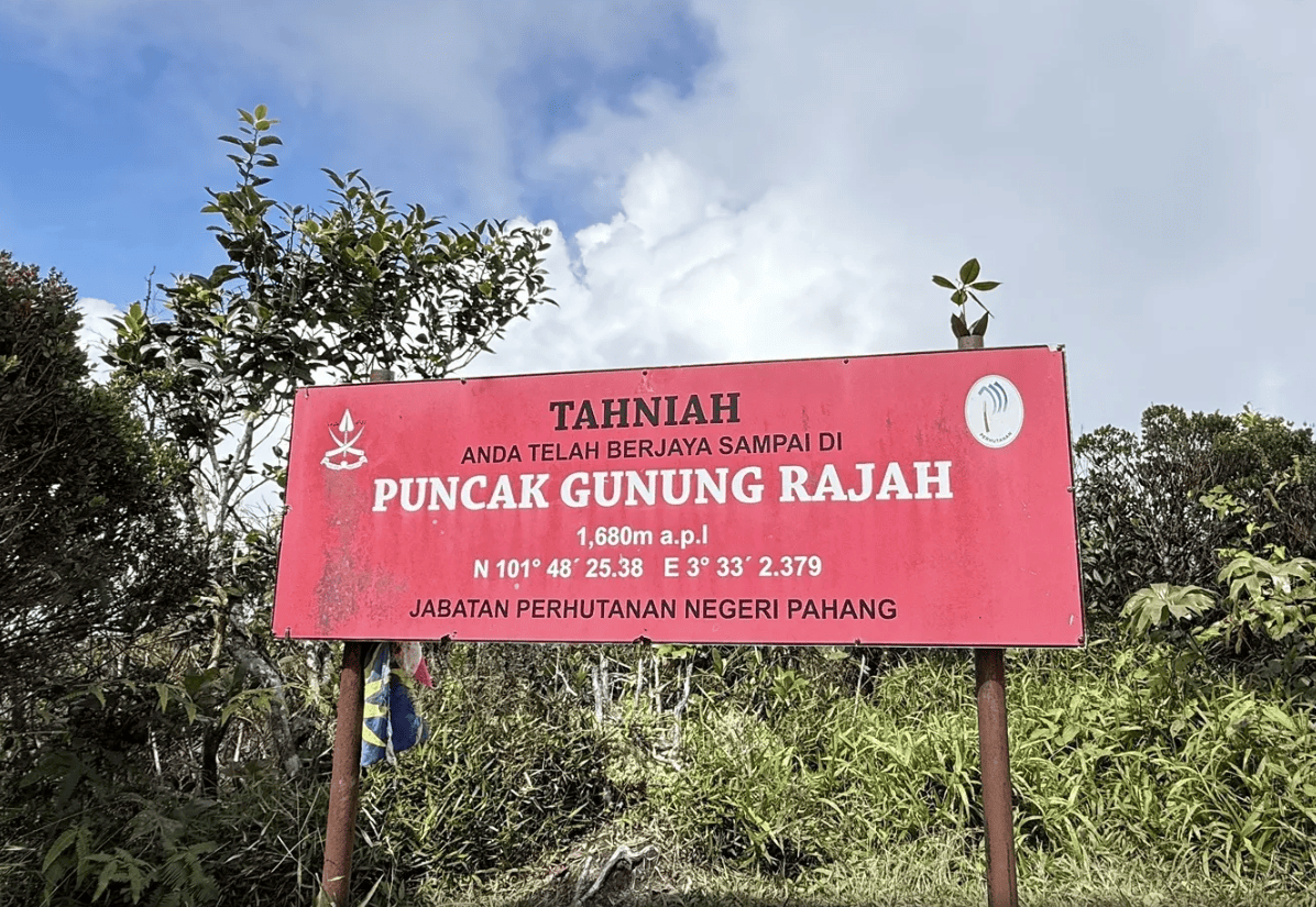
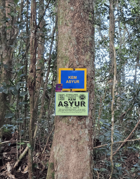
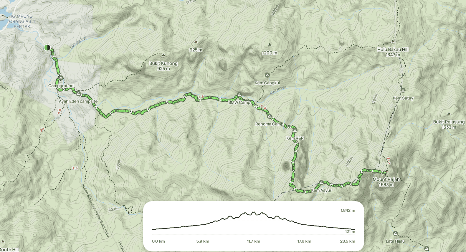
Along the KKB route, hikers will pass several campsites in sequence: Kem BMW > Kem Botol > Kem Renoma > Kem R&R > Kem Asyur. The final push to the summit is the hardest, but the peak rewards hikers with a panoramic view—though sometimes obscured by clouds.
This hike is definitely NOT for beginners. Be prepared for a very demanding trek, and we strongly recommend training a few months in advance.
Hike Information:
📍 Location: Kuala Kubu Bharu, Selangor
📜 Permit: Mandatory
🧑✈️ Licensed MGP Guide: Mandatory
📏 Distance: ~ 25 km (Return)
⛰ Peak Height: 1,685 m / 5,528 ft
📈 Elevation Gain: ~ 2,100 m / ~ 6,889 ft
⚠️ Difficulty Rating: 8/10 (Demanding)
📍 Peak Coordinates: 3°32'58.6"N 101°48'19.4"E 👉 [View on Google Maps]
👥 MGP Guide to Hiker Ratio:
- The standard MGP guide-to-hiker ratio is 1:7.
- If your group has more than 7 participants, additional guides will be required to maintain the mandated safety ratio.
- This requirement ensures safety, compliance with forestry regulations, and a better hiking experience for all participants.
🔢 Ratio Examples:
- 1–7 hikers → 1 guide
- 8–14 hikers → 2 guides
- 15–21 hikers → 3 guides
- 22–28 hikers → 4 guides
💬 Next Steps After Payment:
- 📧 Confirmation: You’ll receive a booking confirmation within 10 minutes. If you don’t receive a confirmation email, please contact our customer support team.
- 📱 WhatsApp Group: All registered participants will be added to a dedicated WhatsApp group for final updates, reminders, and important hike information.
- 🎫 Voucher Type: Please present your mobile voucher along with your identification or passport on the day of the hike.

